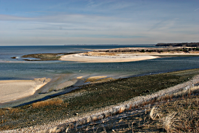
Sunken Meadow State Park

State parks

State parks near Huntington: 2026 guide

The 40 closest state parks and recreation areas, all within 60 miles, with drive times and what is mapped inside each.

Cold Spring Harbor State Park is the closest state park to Huntington, 4 mi west · 9 min drive (5 road mi). This guide lists the 40 closest state parks and recreation areas, all within 60 miles, 20 of them within an hour's drive.

Updated November 2026

Map

Where the parks are

Map of 40 places loads as you scroll.

Closest first

The 40 closest state parks

Straight-line distance from the center of Huntington, then the typical drive without live traffic.

  1. Cold Spring Harbor State Park

    4 mi west · 9 min drive (5 road mi)

    Managed by New York State Office of Parks, Recreation and Historic Preservation

  2. Sunken Meadow State Park

    6 mi east · 12 min drive (8 road mi)

    Mapped inside: 2 picnic sites and 3 playgrounds.

    Managed by New York State Office of Parks, Recreation and Historic Preservation

  3. Trail View State Park

    Trail View State Park

    7 mi southwest · 17 min drive (8 road mi)

    Managed by New York State Office of Parks, Recreation and Historic Preservation

  4. Nissequogue River State Park

    Nissequogue River State Park

    7 mi east · 18 min drive (10 road mi)

    Mapped inside: 1 playground.

    Managed by New York State Office of Parks, Recreation and Historic Preservation

  5. Caleb Smith State Park

    Caleb Smith State Park

    8 mi east · 21 min drive (11 road mi)

    Managed by New York State Office of Parks, Recreation and Historic Preservation

  6. Bethpage State Park

    Bethpage State Park

    10 mi south · 27 min drive (13 road mi)

    Mapped inside: 3 picnic sites and 4 playgrounds.

    Managed by New York State Office of Parks, Recreation and Historic Preservation

  7. Belmont Lake State Park

    Belmont Lake State Park

    11 mi south · 27 min drive (14 road mi)

    Mapped inside: 2 playgrounds.

    Managed by New York State Office of Parks, Recreation and Historic Preservation

  8. Bayard Cutting Arboretum State Park

    Bayard Cutting Arboretum State Park

    15 mi southeast · 35 min drive (22 road mi)

    Managed by New York State Office of Parks, Recreation and Historic Preservation

  9. Heckscher State Park

    Heckscher State Park

    17 mi southeast · 39 min drive (24 road mi)

    Mapped inside: 1 campground, 1 beach, 3 picnic sites and 2 playgrounds.

    Managed by New York State Office of Parks, Recreation and Historic Preservation

  10. Gilgo State Park

    17 mi south · 43 min drive (26 road mi)

    Mapped inside: 1 playground.

    Managed by New York State Office of Parks, Recreation and Historic Preservation

  11. Captree State Park

    Captree State Park

    18 mi south · 37 min drive (22 road mi)

    Mapped inside: 3 beaches and 1 playground.

    Managed by New York State Office of Parks, Recreation and Historic Preservation

  12. Hempstead Lake State Park

    20 mi southwest · 39 min drive (22 road mi)

    Mapped inside: 1 beach, 2 fishing spots, 1 viewpoint, 5 picnic sites and 2 playgrounds.

    Managed by New York State Office of Parks, Recreation and Historic Preservation

  13. Jones Beach State Park

    Jones Beach State Park

    21 mi south · 42 min drive (28 road mi)

    Mapped inside: 12 beaches, 1 fishing spot, 7 picnic sites and 6 playgrounds.

    Managed by New York State Office of Parks, Recreation and Historic Preservation

  14. Valley Stream State Park

    Valley Stream State Park

    22 mi southwest · 47 min drive (26 road mi)

    Mapped inside: 1 picnic site and 4 playgrounds.

    Managed by New York State Office of Parks, Recreation and Historic Preservation

  15. Brookhaven State Park

    27 mi east · 53 min drive (33 road mi)

    Managed by New York State Office of Parks, Recreation and Historic Preservation

  16. Silver Sands State Park

    Silver Sands State Park

    27 mi northeast · 2 hr 9 min by car and ferry (47 mi)

    Mapped inside: 2 beaches and 1 picnic site.

  17. Bayswater Point State Park

    Bayswater Point State Park

    28 mi southwest · 57 min drive (36 road mi)

    Managed by New York State Office of Parks, Recreation and Historic Preservation

  18. Roberto Clemente State Park

    Roberto Clemente State Park

    28 mi west · 1 hr drive (35 road mi)

    Mapped inside: 1 playground.

  19. Old Croton Aqueduct State Park

    28 mi northwest · 1 hr 30 min drive (57 road mi)

    Mapped inside: 1 viewpoint.

  20. Tallman Mountain State Park

    Tallman Mountain State Park

    29 mi west · 1 hr 19 min drive (49 road mi)

    Mapped inside: 1 viewpoint, 2 picnic sites and 1 playground.

    Managed by New York State Office of Parks, Recreation and Historic Preservation

  21. Shirley Chisholm State Park

    Shirley Chisholm State Park

    30 mi southwest · 59 min drive (35 road mi)

    Mapped inside: 1 beach, 1 viewpoint and 16 picnic sites.

    Managed by New York State Office of Parks, Recreation and Historic Preservation

  22. Echo Lake State Park

    30 mi northwest · 1 hr 31 min drive (56 road mi)

  23. Riverbank State Park

    Riverbank State Park

    30 mi west · 1 hr 4 min drive (37 road mi)

    Mapped inside: 2 playgrounds.

    Managed by New York State Office of Parks, Recreation and Historic Preservation

  24. Wildwood State Park

    Wildwood State Park

    31 mi east · 1 hr 4 min drive (38 road mi)

    Mapped inside: 1 campground, 1 playground and 1 visitor center.

    Managed by New York State Office of Parks, Recreation and Historic Preservation

  25. Gantry Plaza State Park

    32 mi west · 58 min drive (36 road mi)

    Mapped inside: 1 picnic site and 1 playground.

  26. Putnam Memorial State Park

    Putnam Memorial State Park

    32 mi north · 2 hr 31 min by car and ferry (59 mi)

    Mapped inside: 3 campgrounds and 1 viewpoint.

  27. FDR Four Freedoms State Park

    FDR Four Freedoms State Park

    32 mi west · 1 hr 6 min drive (38 road mi)

    Mapped inside: 1 viewpoint.

  28. Blauvelt State Park

    32 mi northwest · 1 hr 34 min drive (54 road mi)

    Mapped inside: 1 viewpoint.

  29. Collis P. Huntington State Park

    Collis P. Huntington State Park

    32 mi north · 2 hr 35 min by car and ferry (59 mi)

    Mapped inside: 1 picnic site.

  30. Nyack Beach State Park

    Nyack Beach State Park

    32 mi northwest · 1 hr 33 min drive (56 road mi)

    Mapped inside: 2 viewpoints and 21 picnic sites.

    Managed by New York State Office of Parks, Recreation and Historic Preservation

  31. Marsha P. Johnson State Park

    Marsha P. Johnson State Park

    32 mi west · 58 min drive (37 road mi)

    Mapped inside: 1 beach, 1 viewpoint, 22 picnic sites and 1 playground.

    Managed by New York State Office of Parks, Recreation and Historic Preservation

  32. Wooster Mountain State Park

    Wooster Mountain State Park

    33 mi north · 2 hr 47 min by car and ferry (65 mi)

    Managed by Connecticut Department of Energy and Environmental Protection

  33. Rockland Lake State Park

    33 mi northwest · 1 hr 33 min drive (59 road mi)

    Mapped inside: 1 viewpoint and 1 playground.

    Managed by New York State Office of Parks, Recreation and Historic Preservation

  34. Hook Mountain State Park

    Hook Mountain State Park

    33 mi northwest · 1 hr 35 min drive (59 road mi)

    Mapped inside: 1 viewpoint and 8 picnic sites.

    Managed by New York State Office of Parks, Recreation and Historic Preservation

  35. Indian Well State Park

    Indian Well State Park

    34 mi north · 2 hr 22 min by car and ferry (54 mi)

    Mapped inside: 1 boat ramp and 1 viewpoint.

  36. Osbornedale State Park

    Osbornedale State Park

    35 mi northeast · 2 hr 21 min by car and ferry (55 mi)

    Mapped inside: 1 viewpoint and 2 picnic sites.

  37. Franklin D. Roosevelt State Park

    35 mi northwest · 1 hr 44 min drive (64 road mi)

    Mapped inside: 1 picnic site and 2 playgrounds.

    Managed by New York State Office of Parks, Recreation and Historic Preservation

  38. Haverstraw Beach State Park

    36 mi northwest · 1 hr 33 min drive (60 road mi)

    Managed by New York State Office of Parks, Recreation and Historic Preservation

  39. Liberty State Park

    37 mi west · 1 hr 17 min drive (44 road mi)

    Mapped inside: 2 boat ramps, 3 fishing spots, 6 viewpoints, 54 picnic sites and 5 playgrounds.

  40. High Tor State Park

    38 mi northwest · 1 hr 42 min drive (64 road mi)

    Mapped inside: 6 viewpoints.

    Managed by New York State Office of Parks, Recreation and Historic Preservation

How this list is built

Every park, recreation area, beach or natural area that OpenStreetMap names as a state unit and maps within 60 miles of the center of Huntington, closest first, up to the 40 closest. Places across open water with a much longer drive are left out. The features line counts campgrounds, boat ramps, beaches, trailheads and picnic sites mapped inside the park boundary, so a blank line means nothing is mapped yet, not that the park has none.

FAQ

Questions

What state parks are near Huntington?

Cold Spring Harbor State Park (4 miles), Sunken Meadow State Park (6 miles), Trail View State Park (7 miles), Nissequogue River State Park (7 miles) and Caleb Smith State Park (8 miles) are the closest of the 40 state parks listed here, all within 60 miles of the center of Huntington.

What is the closest state park to Huntington?

Cold Spring Harbor State Park, about 4 miles west of the center of Huntington, a 9 min drive in typical traffic.

Which state parks near Huntington have camping?

OpenStreetMap shows campgrounds or cabins inside Heckscher State Park, Wildwood State Park and Putnam Memorial State Park. Reservations and seasons are set by each state park system.

Which state parks near Huntington have a beach or boat ramp?

Heckscher State Park, Captree State Park, Hempstead Lake State Park, Jones Beach State Park, Silver Sands State Park and 4 more have a mapped boat ramp, beach or swimming area.

How many state parks are within an hour of Huntington?

20 of the 40 parks listed here are within a 60 minute drive of the center of Huntington in typical traffic, by OSRM routing.

Where does this list come from?

State park boundaries and features from OpenStreetMap, photos and links from Wikidata and Wikimedia Commons, and drive times from OSRM, checked November 2026. Fees, hours and closures come from each state park system.

Sources: © OpenStreetMap contributors (ODbL), Wikidata (CC0), photos from Wikimedia Commons credited below, and OSRM drive times, checked November 2026. Check each park's official page for fees, hours and closures before you go.

In and near

In and near Huntington

The same guide on other Local City Network sites close by.

Huntington AI

Your Huntington local guide
Hey there!

I'm Huntington AI. Ask about neighborhood food, independent shops, local history or planning a visit.

AI recommendations may be inaccurate. Verify hours and prices. Questions are processed by Cloudflare. Privacy